


 |
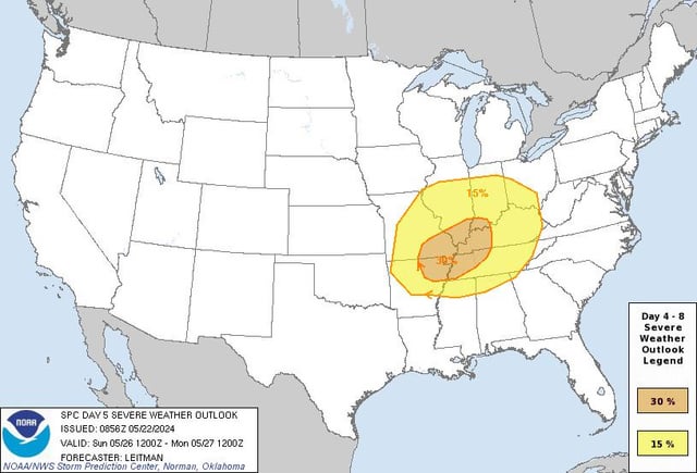
A synoptic worrying pattern is evident across a broad area of the central US on Sunday. The upper trough of the Day 4/Sat period will shift further east across the Midwest on Sunday. This will allow strong mid/upper southwest flow to spread across the region as a deepening MO surface low moves toward Lake Michigan. Strong to severe thunderstorms may persist in parts of the MO/Ozarks area. Ahead of this activity, a rapidly wetting boundary layer with dew points in the upper 60s to low 70s F is expected to envelop much of the Mid-MS/OH/TN valleys. Strong destabilization and favorable vertical shear, along with an eastward advancing cold front, will support both supercell storms and possibly a developing all-hazards capable QLCS. While details regarding morning convection and storm mode remain somewhat uncertain, a more severe potential appears possible with this pattern in parts of the region from the afternoon to overnight hours. submitted by /u/Sweet_Tea245 |


